Data to Explore on Indigenous People's Day & Everyday
By: Kristin Hunter-Thomson
Wondering what Indigenous nations were in your area before being removed and relocated into designated reservations or other areas?
Curious what data and graphs you can use to help your students make sense of where Indigenous nations currently are and/or lived in the past?
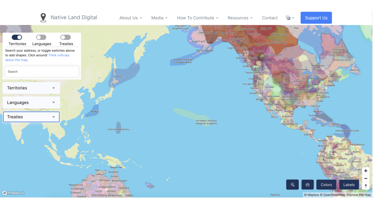
Native Land Digital is accessible at https://native-land.ca/
I highly recommend exploring the Native Land Digital resources! Native Land Digital is a Indigenous-led, Canadian not-for-profit organization.
You can search their interactive map for territories by entering current location names. You can also search for the locations in which specific languages were and are spoken. As well, you can search a wide range of treaties.
They also have a Teacher Guide to help use the resources more!
Jump in, check it out, share it with your colleagues, and help your students spatially make sense of Indigenous nations in new ways.
As a note, Native Land Digital explicitly states that the interactive map is not intended to nor actually represents official or legal boundaries of any Indigenous nations. But it is an incredible resource of organization-vetted and crowdsourced information. If you are looking for official or legal boundaries, they recommend contacting the Indigenous nation directly.
They welcome any and all suggestions of errors you find in the map, so be sure to reach out to them if you have some suggestions.
We are based in Princeton, NJ, which is the traditional homelands of the Lənape Haki-nk (Lenni-Lenape) people before being removed into designated reservations. We offer our respect, acknowledge the injustices that separated you from the land, recognize our responsibility to learn, and honor your foundational contributions to science, technology, and societies around the world.
